
Land Surveyor
भूमि सर्वेक्षकAccurate plot measurement, levels and demarcation on hill terrain.
Every good building starts with correct measurements. We survey plots with proper instruments, record levels on sloped land and mark boundaries clearly, so your map, your estimate and your construction all start from the same true numbers.
How it works.
Step 01
Visit
We come to the site with survey equipment.
Step 02
Measure
Boundaries, levels and existing features recorded.
Step 03
Draw
A clear site plan with dimensions and area.
Step 04
Mark
Boundaries or building layout marked on the ground.
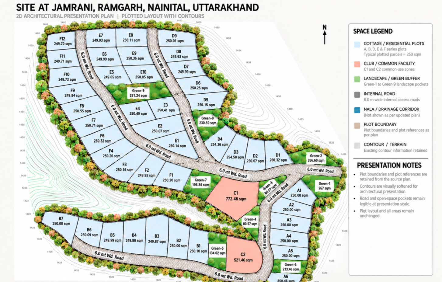
From contours to a layout.
A plotted layout drawn over the site contours for a hillside cottage township at Jamrani, Ramgarh, in Nainital district.
Common questions.
Something else on your mind? Ask us on WhatsApp.
Why is a level survey needed on hill plots?
On a slope, the height difference across the plot decides the foundation, retaining walls and even the number of floors. A level survey avoids costly surprises later.
Guides on this
All guides Survey
4 min read
Nali to square feet: land units in Nainital and Kumaon, with a conversion table
1 nali is 2,160 sq ft, 240 gaj or about 200.7 sq m. A quick conversion table for nali and mutthi, and why slope makes hill plots measure bigger than they are.
Read article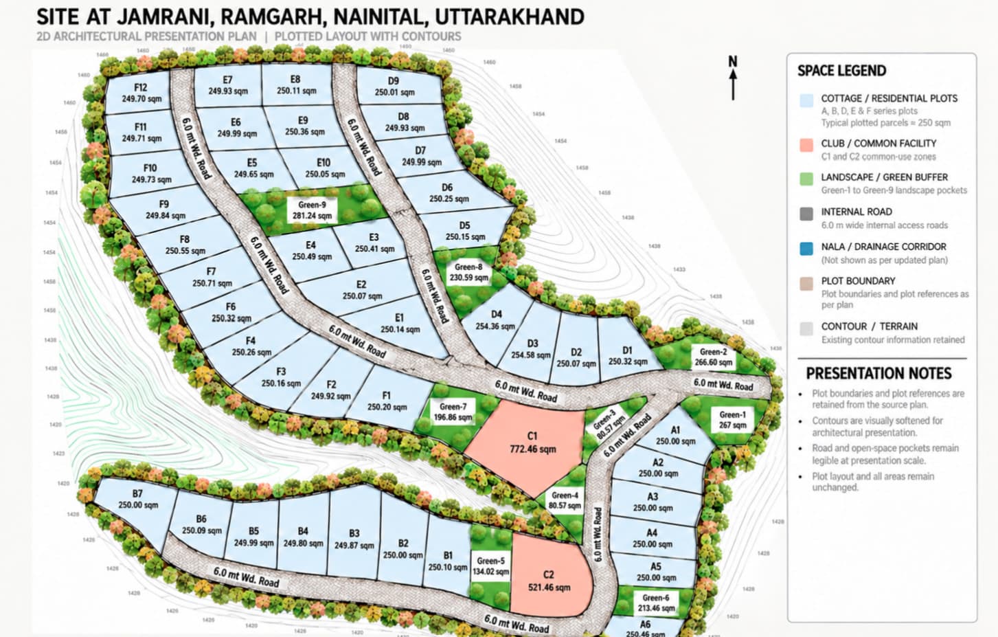 Survey
3 min read
Plot demarcation in Nainital district: how boundaries are measured and marked
Terraced land, old village maps and missing boundary stones: how a demarcation survey fixes your plot's boundaries in Bhimtal, Bhowali or Ramgarh.
Read article- Survey
2 min read
Building on a slope? Start with a level survey
On a hill plot, the height difference across the land decides your foundation, retaining walls and budget. Here is why the survey comes first.
Read article




Ready to start? Talk to an engineer.
Share your plot location and what you need. We will explain the next step for Land Surveyor.